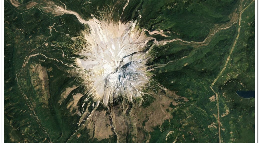
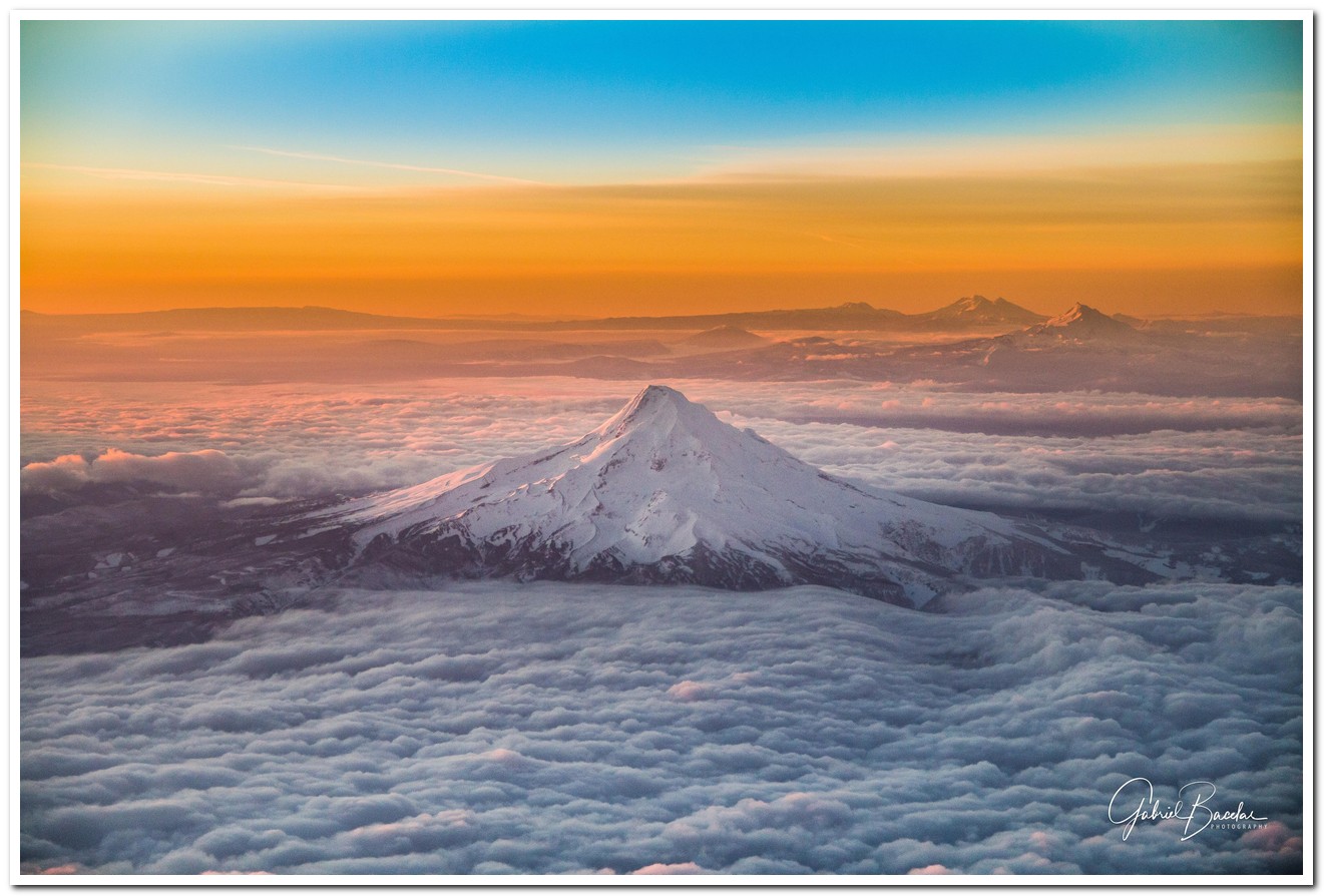
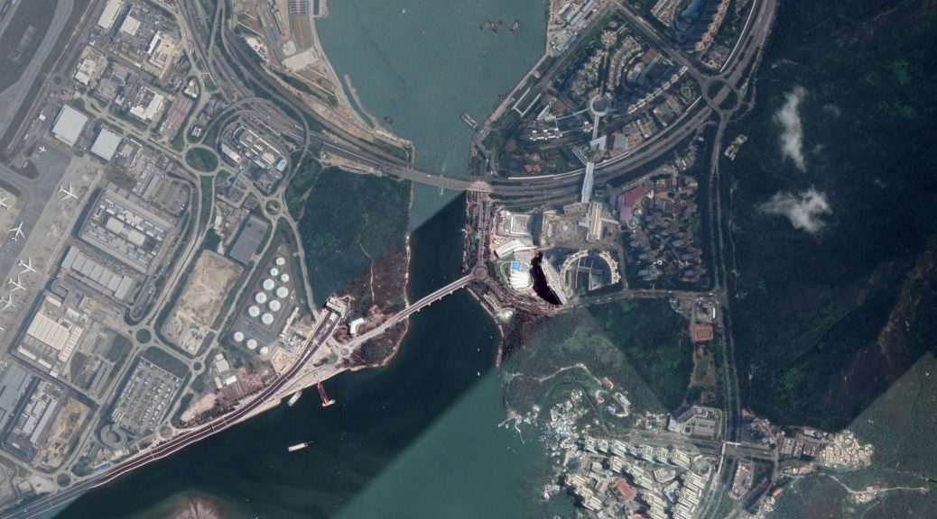
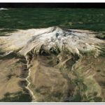
All credit for the original image goes to gabriel_evb , who posted this work of his at reddit
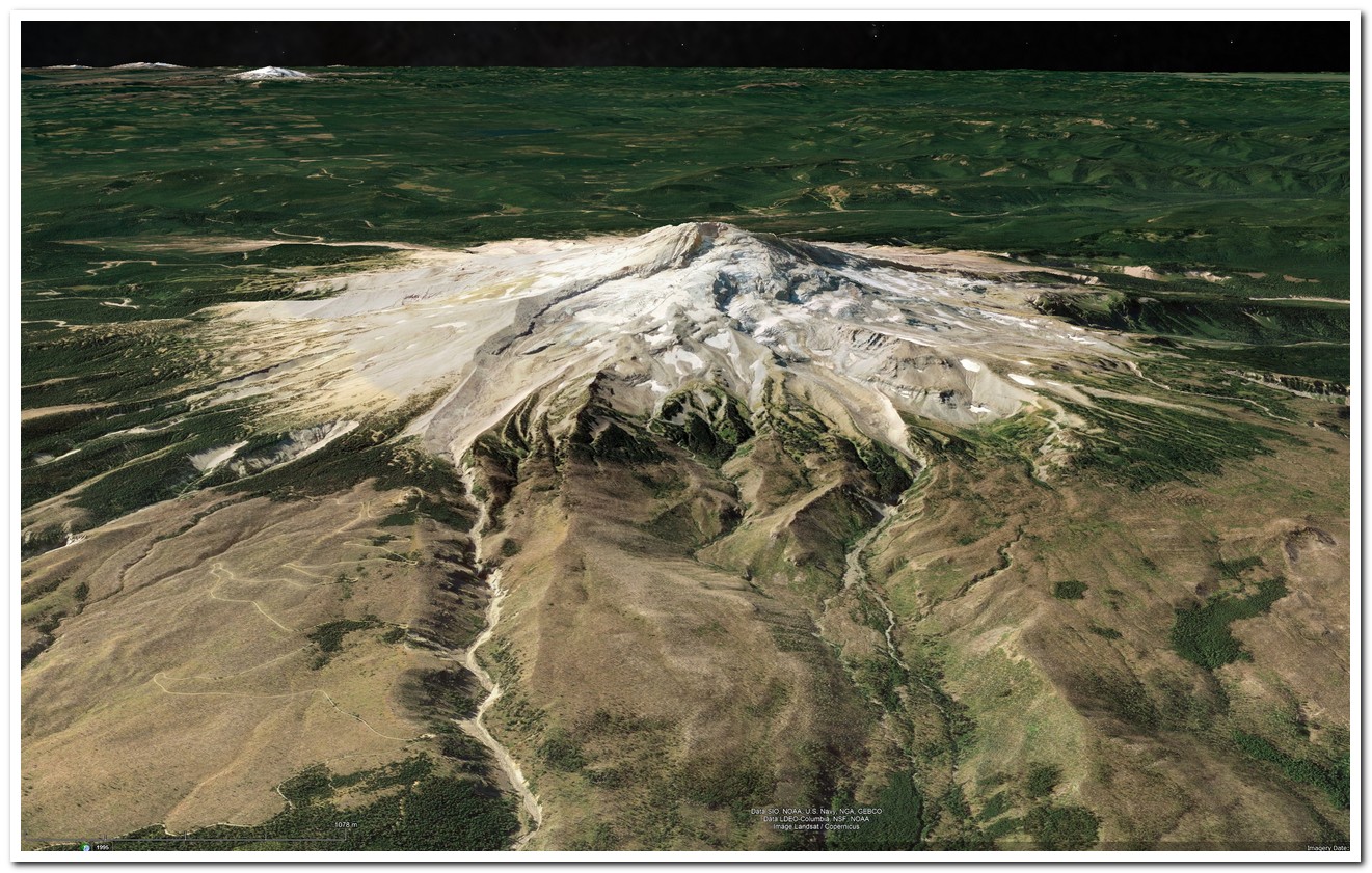
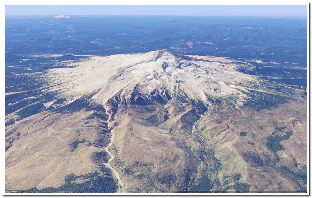
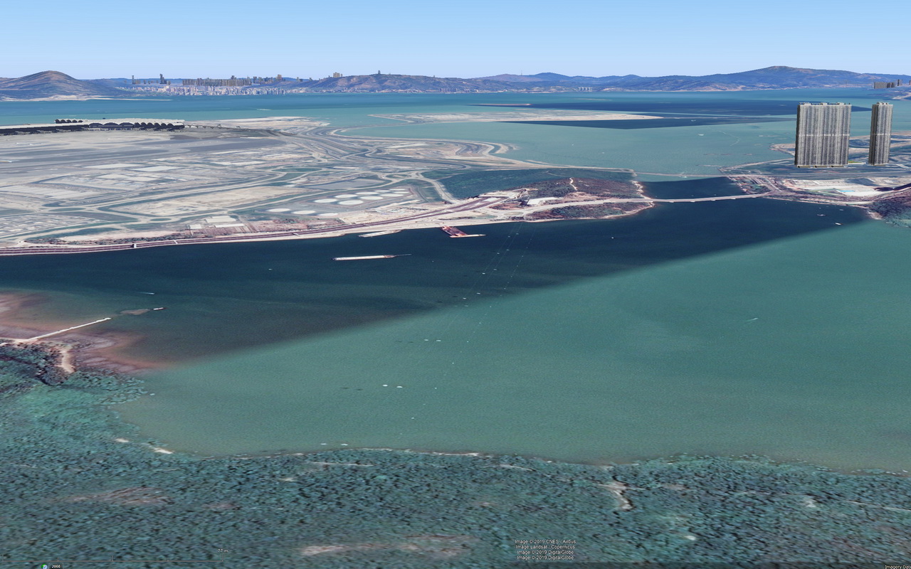
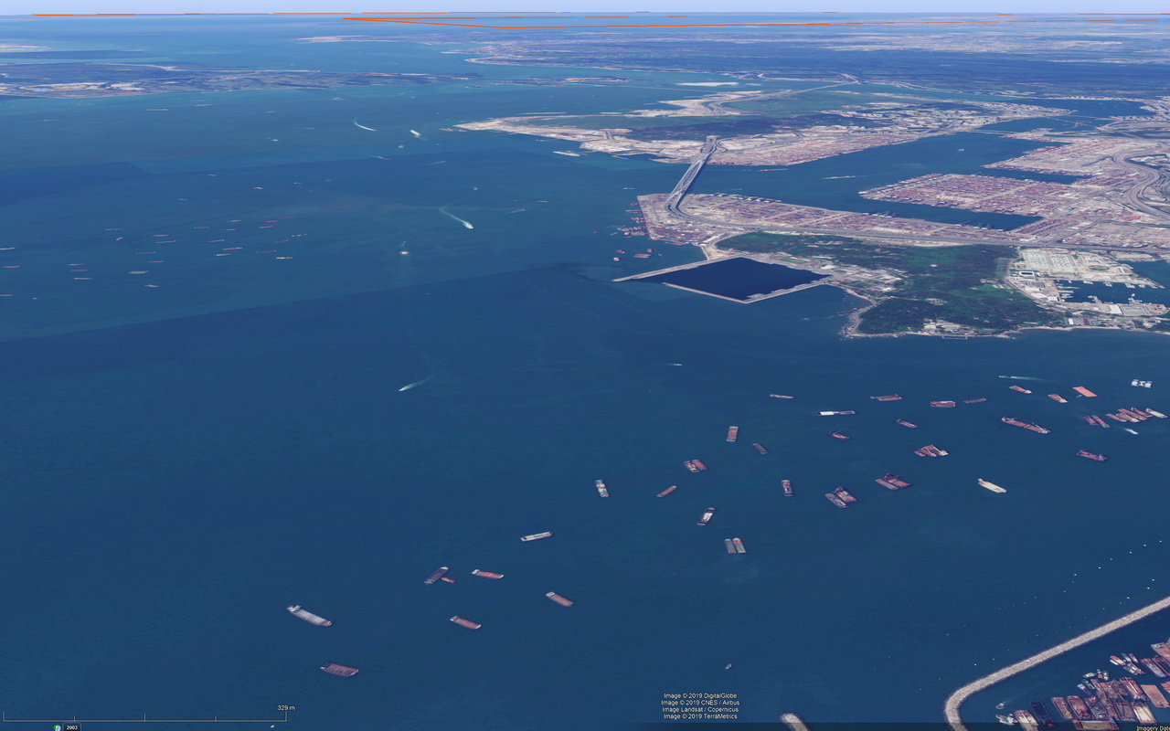
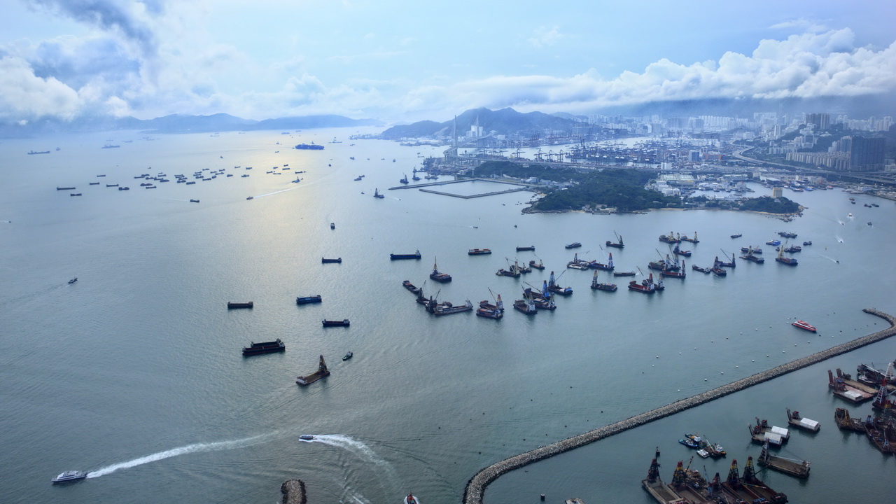
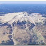
The following “Google Earth” images are taken from exactly the same placemark location, one without atmosphere (less realistic, but with more explicit terrain details), the other with atmosphere (more realistic, but occluding some terrain details).
I intensely adore Google Earth Pro (GE), and consider it one of the most empowering pieces of software ever written, if not the absolute leader in the category. With GE you can travel to anywhere in the world and discover that region with a detail that goes beyond what was previously dreamt even in science fiction.
It is a wonderful experience to instantly go to places whose name you do not even have to know, and walk its streets, fly over any of its locations, and get a solid objective notion of the scale and surroundings of whatever captures one’s attention. Thank you, oh thank you modern times for this amazing, awesome tool!
One of the fun activities I do with GE is to snapshot locations, which roughly correspond to “real life” photos I find on the Internet. My academic bots usually harvest pictures on Reddit, and that network is my most common source of photos of places, that I’ll then try to locate in Google Earth.
Sometimes I will not be able to, or I will make mistakes in referring the correct original author(s), so – in advance – I am sorry for the lack of credit, or wrong credit, to the author(s) of the original photo(s). I am continuously trying to learn and improve my software solutions, including the harvesting bots, to properly fetch and embed the correct metadata.
Anyway, these posts labelled "real vs Google Earth" will usually consist of three elements:
– the original photo, found somewhere on the Internet, or of my own authorship;
– a Google Earth Pro snapshot which is a rough perspective of the place;
– a ZIP of a KMZ file containing a “placemark” that you can import into your GE and observe the perspective yourself.
You can download the offline installer for Google Earth Pro here:
https://support.google.com/earth/answer/168344
Enjoy!
Mount_Hood__Oregon.zip
https://arturmarques.com/wp/wp-content/uploads/2019/06/Mount_Hood__Oregon.zip (application/zip)
Technical Details
- ./ups/0mount_hood_oregon_1280.jpg
- attachment_id : 269
- date_created_gmt : 2019-06-09 17:00:22
- parent : 0
- link : https://arturmarques.com/wp/wp-content/uploads/2019/06/0mount_hood_oregon_1280.jpg
- title : 0mount_hood_oregon_1280.jpg
- caption :
- description :
- metadata :
- width : 1321
- height : 894
- file : 2019/06/0mount_hood_oregon_1280.jpg
- sizes :
- thumbnail :
- file : 0mount_hood_oregon_1280-150×150.jpg
- width : 150
- height : 150
- mime-type : image/jpeg
- medium :
- file : 0mount_hood_oregon_1280-300×203.jpg
- width : 300
- height : 203
- mime-type : image/jpeg
- medium_large :
- file : 0mount_hood_oregon_1280-768×520.jpg
- width : 768
- height : 520
- mime-type : image/jpeg
- large :
- file : 0mount_hood_oregon_1280-1024×693.jpg
- width : 1024
- height : 693
- mime-type : image/jpeg
- post-thumbnail :
- file : 0mount_hood_oregon_1280-672×372.jpg
- width : 672
- height : 372
- mime-type : image/jpeg
- twentyfourteen-full-width :
- file : 0mount_hood_oregon_1280-1038×576.jpg
- width : 1038
- height : 576
- mime-type : image/jpeg
- thumbnail :
- image_meta :
- aperture : 0
- credit :
- camera :
- caption :
- created_timestamp : 0
- copyright :
- focal_length : 0
- iso : 0
- shutter_speed : 0
- title :
- orientation : 0
- keywords :
- type : image/jpeg
- thumbnail : https://arturmarques.com/wp/wp-content/uploads/2019/06/0mount_hood_oregon_1280-150×150.jpg
- id : 269
- file : 0mount_hood_oregon_1280.jpg
- url : https://arturmarques.com/wp/wp-content/uploads/2019/06/0mount_hood_oregon_1280.jpg
- ./ups/1ge_mount_hood_oregon_no_atmosphere_1280.jpg
- attachment_id : 270
- date_created_gmt : 2019-06-09 17:00:26
- parent : 0
- link : https://arturmarques.com/wp/wp-content/uploads/2019/06/1ge_mount_hood_oregon_no_atmosphere_1280.jpg
- title : 1ge_mount_hood_oregon_no_atmosphere_1280.jpg
- caption :
- description :
- metadata :
- width : 1321
- height : 841
- file : 2019/06/1ge_mount_hood_oregon_no_atmosphere_1280.jpg
- sizes :
- thumbnail :
- file : 1ge_mount_hood_oregon_no_atmosphere_1280-150×150.jpg
- width : 150
- height : 150
- mime-type : image/jpeg
- medium :
- file : 1ge_mount_hood_oregon_no_atmosphere_1280-300×191.jpg
- width : 300
- height : 191
- mime-type : image/jpeg
- medium_large :
- file : 1ge_mount_hood_oregon_no_atmosphere_1280-768×489.jpg
- width : 768
- height : 489
- mime-type : image/jpeg
- large :
- file : 1ge_mount_hood_oregon_no_atmosphere_1280-1024×652.jpg
- width : 1024
- height : 652
- mime-type : image/jpeg
- post-thumbnail :
- file : 1ge_mount_hood_oregon_no_atmosphere_1280-672×372.jpg
- width : 672
- height : 372
- mime-type : image/jpeg
- twentyfourteen-full-width :
- file : 1ge_mount_hood_oregon_no_atmosphere_1280-1038×576.jpg
- width : 1038
- height : 576
- mime-type : image/jpeg
- thumbnail :
- image_meta :
- aperture : 0
- credit :
- camera :
- caption :
- created_timestamp : 0
- copyright :
- focal_length : 0
- iso : 0
- shutter_speed : 0
- title :
- orientation : 0
- keywords :
- type : image/jpeg
- thumbnail : https://arturmarques.com/wp/wp-content/uploads/2019/06/1ge_mount_hood_oregon_no_atmosphere_1280-150×150.jpg
- id : 270
- file : 1ge_mount_hood_oregon_no_atmosphere_1280.jpg
- url : https://arturmarques.com/wp/wp-content/uploads/2019/06/1ge_mount_hood_oregon_no_atmosphere_1280.jpg
- ./ups/2ge_mount_hood_oregon_w_atmosphere_1280.jpg
- attachment_id : 271
- date_created_gmt : 2019-06-09 17:00:34
- parent : 0
- link : https://arturmarques.com/wp/wp-content/uploads/2019/06/2ge_mount_hood_oregon_w_atmosphere_1280.jpg
- title : 2ge_mount_hood_oregon_w_atmosphere_1280.jpg
- caption :
- description :
- metadata :
- width : 1321
- height : 841
- file : 2019/06/2ge_mount_hood_oregon_w_atmosphere_1280.jpg
- sizes :
- thumbnail :
- file : 2ge_mount_hood_oregon_w_atmosphere_1280-150×150.jpg
- width : 150
- height : 150
- mime-type : image/jpeg
- medium :
- file : 2ge_mount_hood_oregon_w_atmosphere_1280-300×191.jpg
- width : 300
- height : 191
- mime-type : image/jpeg
- medium_large :
- file : 2ge_mount_hood_oregon_w_atmosphere_1280-768×489.jpg
- width : 768
- height : 489
- mime-type : image/jpeg
- large :
- file : 2ge_mount_hood_oregon_w_atmosphere_1280-1024×652.jpg
- width : 1024
- height : 652
- mime-type : image/jpeg
- post-thumbnail :
- file : 2ge_mount_hood_oregon_w_atmosphere_1280-672×372.jpg
- width : 672
- height : 372
- mime-type : image/jpeg
- twentyfourteen-full-width :
- file : 2ge_mount_hood_oregon_w_atmosphere_1280-1038×576.jpg
- width : 1038
- height : 576
- mime-type : image/jpeg
- thumbnail :
- image_meta :
- aperture : 0
- credit :
- camera :
- caption :
- created_timestamp : 0
- copyright :
- focal_length : 0
- iso : 0
- shutter_speed : 0
- title :
- orientation : 0
- keywords :
- type : image/jpeg
- thumbnail : https://arturmarques.com/wp/wp-content/uploads/2019/06/2ge_mount_hood_oregon_w_atmosphere_1280-150×150.jpg
- id : 271
- file : 2ge_mount_hood_oregon_w_atmosphere_1280.jpg
- url : https://arturmarques.com/wp/wp-content/uploads/2019/06/2ge_mount_hood_oregon_w_atmosphere_1280.jpg
- ./ups/Mount_Hood__Oregon.zip
- attachment_id : 272
- date_created_gmt : 2019-06-09 17:00:36
- parent : 0
- link : https://arturmarques.com/wp/wp-content/uploads/2019/06/Mount_Hood__Oregon.zip
- title : Mount_Hood__Oregon.zip
- caption :
- description :
- metadata :
- type : application/zip
- thumbnail : https://arturmarques.com/wp/wp-content/uploads/2019/06/Mount_Hood__Oregon.zip
- id : 272
- file : Mount_Hood__Oregon.zip
- url : https://arturmarques.com/wp/wp-content/uploads/2019/06/Mount_Hood__Oregon.zip


