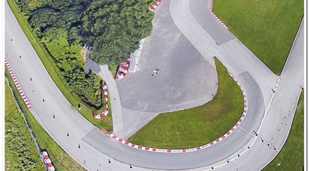
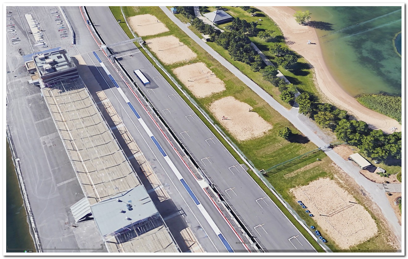
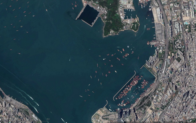
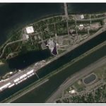
Google Earth shows what seems to be a white car sinking into the asphalt at the first turn of circuit Gilles Villeneuve, Canada. I just hope that no driver needs to take that escape route today! The race starts in 15 minutes… 🙂
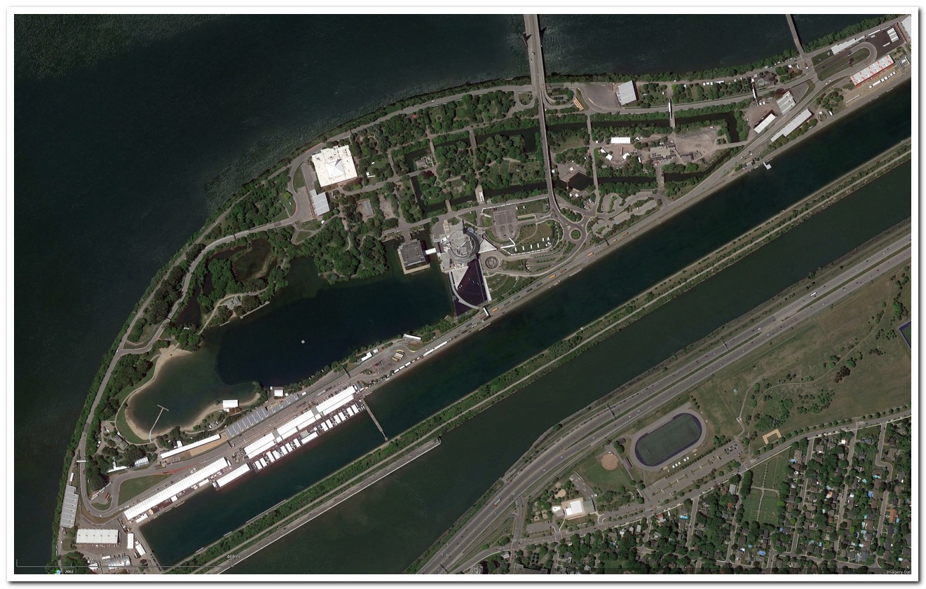
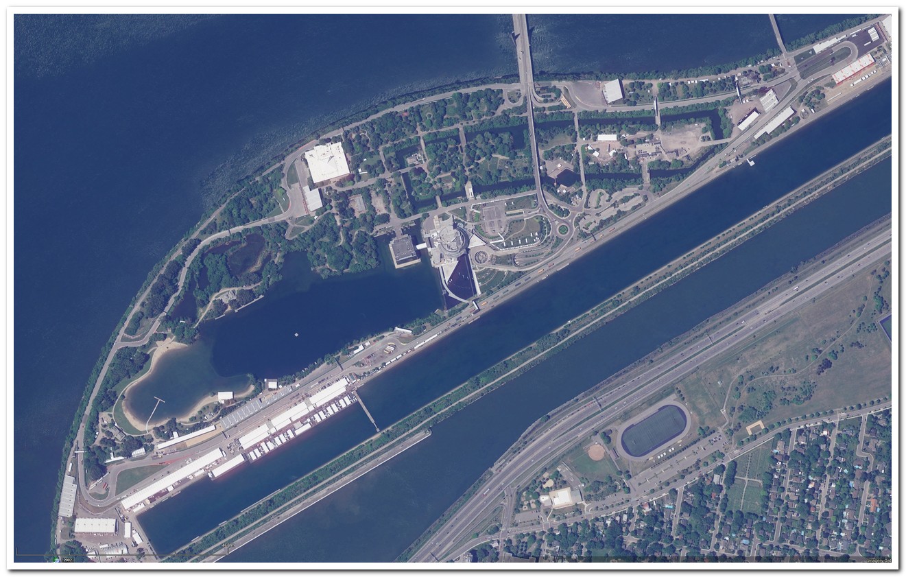
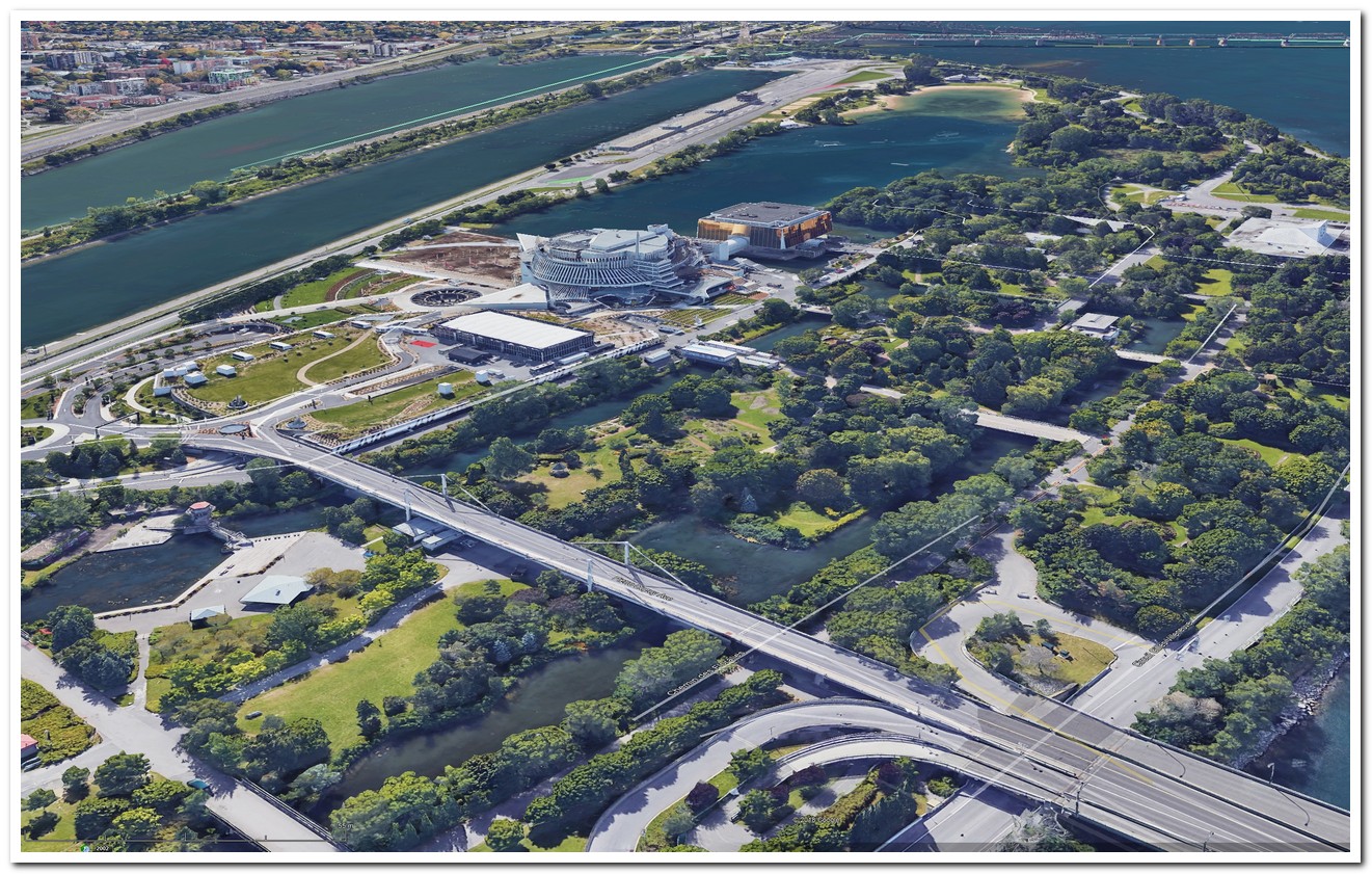
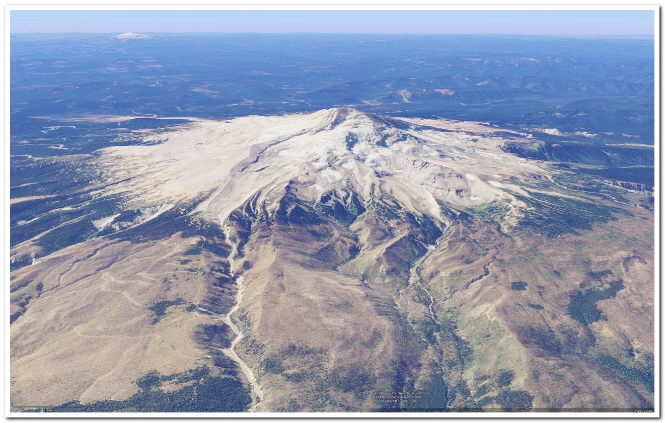
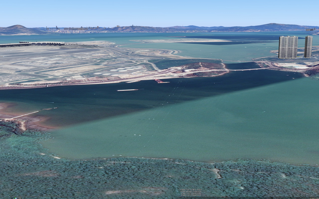
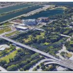
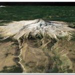
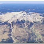
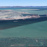
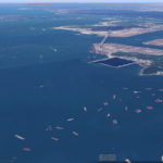
Besides that funny detail, great imagery from Google Earth, as usual. What follows are some pictures of the circuit, namely two diagonal views (with and without “atmosphere”) which capture the entire layout, one perspective of the surroundings, and the starting line.
You’ll also find a ZIP of a KMZ file containing a “placemark” that you can import into your GE and observe it yourself.
The_sinking_car_at_Circuit_Gilles_Villeneuve.zip
https://arturmarques.com/wp/wp-content/uploads/2019/06/The_sinking_car_at_Circuit_Gilles_Villeneuve.zip (application/zip)
Technical Details
- ./ups/1ge_circuit_gilles_villeneuve_1280.jpg
- attachment_id : 279
- date_created_gmt : 2019-06-09 18:00:42
- parent : 0
- link : https://arturmarques.com/wp/wp-content/uploads/2019/06/1ge_circuit_gilles_villeneuve_1280.jpg
- title : 1ge_circuit_gilles_villeneuve_1280.jpg
- caption :
- description :
- metadata :
- width : 1321
- height : 841
- file : 2019/06/1ge_circuit_gilles_villeneuve_1280.jpg
- sizes :
- thumbnail :
- file : 1ge_circuit_gilles_villeneuve_1280-150×150.jpg
- width : 150
- height : 150
- mime-type : image/jpeg
- medium :
- file : 1ge_circuit_gilles_villeneuve_1280-300×191.jpg
- width : 300
- height : 191
- mime-type : image/jpeg
- medium_large :
- file : 1ge_circuit_gilles_villeneuve_1280-768×489.jpg
- width : 768
- height : 489
- mime-type : image/jpeg
- large :
- file : 1ge_circuit_gilles_villeneuve_1280-1024×652.jpg
- width : 1024
- height : 652
- mime-type : image/jpeg
- post-thumbnail :
- file : 1ge_circuit_gilles_villeneuve_1280-672×372.jpg
- width : 672
- height : 372
- mime-type : image/jpeg
- twentyfourteen-full-width :
- file : 1ge_circuit_gilles_villeneuve_1280-1038×576.jpg
- width : 1038
- height : 576
- mime-type : image/jpeg
- thumbnail :
- image_meta :
- aperture : 0
- credit :
- camera :
- caption :
- created_timestamp : 0
- copyright :
- focal_length : 0
- iso : 0
- shutter_speed : 0
- title :
- orientation : 0
- keywords :
- type : image/jpeg
- thumbnail : https://arturmarques.com/wp/wp-content/uploads/2019/06/1ge_circuit_gilles_villeneuve_1280-150×150.jpg
- id : 279
- file : 1ge_circuit_gilles_villeneuve_1280.jpg
- url : https://arturmarques.com/wp/wp-content/uploads/2019/06/1ge_circuit_gilles_villeneuve_1280.jpg
- ./ups/2ge_circuit_gilles_villeneuve_1280.jpg
- attachment_id : 280
- date_created_gmt : 2019-06-09 18:00:48
- parent : 0
- link : https://arturmarques.com/wp/wp-content/uploads/2019/06/2ge_circuit_gilles_villeneuve_1280.jpg
- title : 2ge_circuit_gilles_villeneuve_1280.jpg
- caption :
- description :
- metadata :
- width : 1321
- height : 841
- file : 2019/06/2ge_circuit_gilles_villeneuve_1280.jpg
- sizes :
- thumbnail :
- file : 2ge_circuit_gilles_villeneuve_1280-150×150.jpg
- width : 150
- height : 150
- mime-type : image/jpeg
- medium :
- file : 2ge_circuit_gilles_villeneuve_1280-300×191.jpg
- width : 300
- height : 191
- mime-type : image/jpeg
- medium_large :
- file : 2ge_circuit_gilles_villeneuve_1280-768×489.jpg
- width : 768
- height : 489
- mime-type : image/jpeg
- large :
- file : 2ge_circuit_gilles_villeneuve_1280-1024×652.jpg
- width : 1024
- height : 652
- mime-type : image/jpeg
- post-thumbnail :
- file : 2ge_circuit_gilles_villeneuve_1280-672×372.jpg
- width : 672
- height : 372
- mime-type : image/jpeg
- twentyfourteen-full-width :
- file : 2ge_circuit_gilles_villeneuve_1280-1038×576.jpg
- width : 1038
- height : 576
- mime-type : image/jpeg
- thumbnail :
- image_meta :
- aperture : 0
- credit :
- camera :
- caption :
- created_timestamp : 0
- copyright :
- focal_length : 0
- iso : 0
- shutter_speed : 0
- title :
- orientation : 0
- keywords :
- type : image/jpeg
- thumbnail : https://arturmarques.com/wp/wp-content/uploads/2019/06/2ge_circuit_gilles_villeneuve_1280-150×150.jpg
- id : 280
- file : 2ge_circuit_gilles_villeneuve_1280.jpg
- url : https://arturmarques.com/wp/wp-content/uploads/2019/06/2ge_circuit_gilles_villeneuve_1280.jpg
- ./ups/3ge_circuit_gilles_villeneuve_1280.jpg
- attachment_id : 281
- date_created_gmt : 2019-06-09 18:00:52
- parent : 0
- link : https://arturmarques.com/wp/wp-content/uploads/2019/06/3ge_circuit_gilles_villeneuve_1280.jpg
- title : 3ge_circuit_gilles_villeneuve_1280.jpg
- caption :
- description :
- metadata :
- width : 1321
- height : 841
- file : 2019/06/3ge_circuit_gilles_villeneuve_1280.jpg
- sizes :
- thumbnail :
- file : 3ge_circuit_gilles_villeneuve_1280-150×150.jpg
- width : 150
- height : 150
- mime-type : image/jpeg
- medium :
- file : 3ge_circuit_gilles_villeneuve_1280-300×191.jpg
- width : 300
- height : 191
- mime-type : image/jpeg
- medium_large :
- file : 3ge_circuit_gilles_villeneuve_1280-768×489.jpg
- width : 768
- height : 489
- mime-type : image/jpeg
- large :
- file : 3ge_circuit_gilles_villeneuve_1280-1024×652.jpg
- width : 1024
- height : 652
- mime-type : image/jpeg
- post-thumbnail :
- file : 3ge_circuit_gilles_villeneuve_1280-672×372.jpg
- width : 672
- height : 372
- mime-type : image/jpeg
- twentyfourteen-full-width :
- file : 3ge_circuit_gilles_villeneuve_1280-1038×576.jpg
- width : 1038
- height : 576
- mime-type : image/jpeg
- thumbnail :
- image_meta :
- aperture : 0
- credit :
- camera :
- caption :
- created_timestamp : 0
- copyright :
- focal_length : 0
- iso : 0
- shutter_speed : 0
- title :
- orientation : 0
- keywords :
- type : image/jpeg
- thumbnail : https://arturmarques.com/wp/wp-content/uploads/2019/06/3ge_circuit_gilles_villeneuve_1280-150×150.jpg
- id : 281
- file : 3ge_circuit_gilles_villeneuve_1280.jpg
- url : https://arturmarques.com/wp/wp-content/uploads/2019/06/3ge_circuit_gilles_villeneuve_1280.jpg
- ./ups/4ge_circuit_gilles_villeneuve_1280.jpg
- attachment_id : 282
- date_created_gmt : 2019-06-09 18:00:57
- parent : 0
- link : https://arturmarques.com/wp/wp-content/uploads/2019/06/4ge_circuit_gilles_villeneuve_1280.jpg
- title : 4ge_circuit_gilles_villeneuve_1280.jpg
- caption :
- description :
- metadata :
- width : 1321
- height : 841
- file : 2019/06/4ge_circuit_gilles_villeneuve_1280.jpg
- sizes :
- thumbnail :
- file : 4ge_circuit_gilles_villeneuve_1280-150×150.jpg
- width : 150
- height : 150
- mime-type : image/jpeg
- medium :
- file : 4ge_circuit_gilles_villeneuve_1280-300×191.jpg
- width : 300
- height : 191
- mime-type : image/jpeg
- medium_large :
- file : 4ge_circuit_gilles_villeneuve_1280-768×489.jpg
- width : 768
- height : 489
- mime-type : image/jpeg
- large :
- file : 4ge_circuit_gilles_villeneuve_1280-1024×652.jpg
- width : 1024
- height : 652
- mime-type : image/jpeg
- post-thumbnail :
- file : 4ge_circuit_gilles_villeneuve_1280-672×372.jpg
- width : 672
- height : 372
- mime-type : image/jpeg
- twentyfourteen-full-width :
- file : 4ge_circuit_gilles_villeneuve_1280-1038×576.jpg
- width : 1038
- height : 576
- mime-type : image/jpeg
- thumbnail :
- image_meta :
- aperture : 0
- credit :
- camera :
- caption :
- created_timestamp : 0
- copyright :
- focal_length : 0
- iso : 0
- shutter_speed : 0
- title :
- orientation : 0
- keywords :
- type : image/jpeg
- thumbnail : https://arturmarques.com/wp/wp-content/uploads/2019/06/4ge_circuit_gilles_villeneuve_1280-150×150.jpg
- id : 282
- file : 4ge_circuit_gilles_villeneuve_1280.jpg
- url : https://arturmarques.com/wp/wp-content/uploads/2019/06/4ge_circuit_gilles_villeneuve_1280.jpg
- ./ups/The_sinking_car_at_Circuit_Gilles_Villeneuve.zip
- attachment_id : 283
- date_created_gmt : 2019-06-09 18:00:59
- parent : 0
- link : https://arturmarques.com/wp/wp-content/uploads/2019/06/The_sinking_car_at_Circuit_Gilles_Villeneuve.zip
- title : The_sinking_car_at_Circuit_Gilles_Villeneuve.zip
- caption :
- description :
- metadata :
- type : application/zip
- thumbnail : https://arturmarques.com/wp/wp-content/uploads/2019/06/The_sinking_car_at_Circuit_Gilles_Villeneuve.zip
- id : 283
- file : The_sinking_car_at_Circuit_Gilles_Villeneuve.zip
- url : https://arturmarques.com/wp/wp-content/uploads/2019/06/The_sinking_car_at_Circuit_Gilles_Villeneuve.zip


